Stage 1 key zones ┃ Explore each zone ┃ Overarching plan for stage 1 ┃ FAQs ┃ Share your thoughts ┃ Contact us
Laying the foundations for next 10 years
Stage 1 focuses on revitalising existing spaces, improving connectivity and laying the groundwork for future transformation on land that is under Council’s influence or direct control.
This stage will ensure the foundations are in place for a precinct that prioritises people, sustainability and community life.
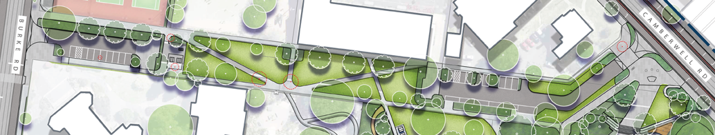
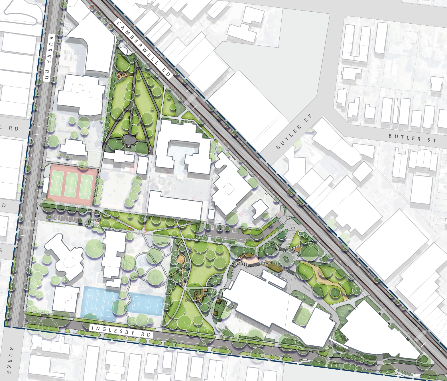
Key zones in stage 1
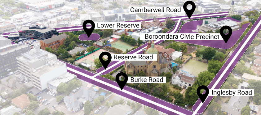
Map showing key zones in stage 1
The improvements proposed in the master plan for the next 10 years are not currently budgeted by Council. If councillors adopt the master plan, any proposed works would be considered for funding in future Council budgets.
Explore each zone
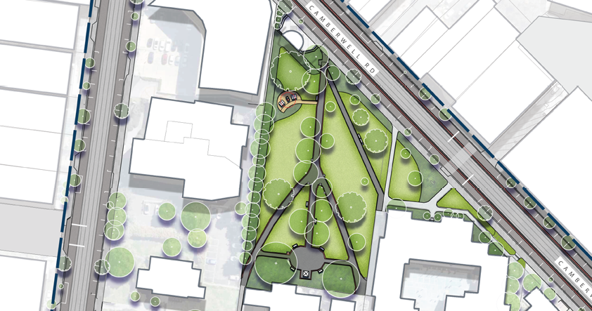
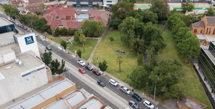
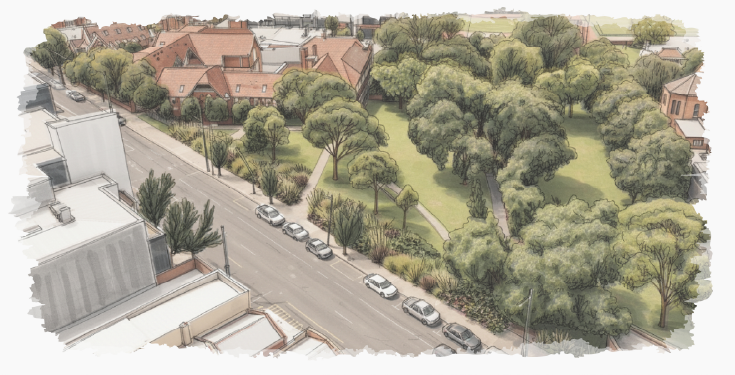
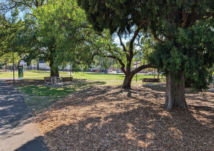
Lower Reserve
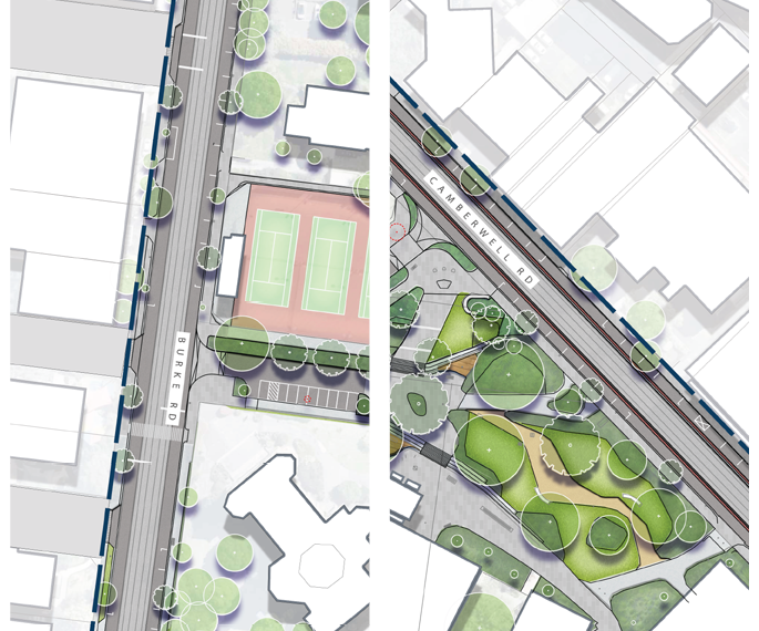
Lower Reserve is located next to Camberwell Primary School on Camberwell Road. This site became a garden reserve in 1885. It still features many trees and plantings from the 1870s. We plan to look after and improve this green space, with potential to add more places to relax and better links to nearby areas.
Recommendations
Select the hotspots on the map to view the recommendations:
Hotspot colours in the above map align to each of the following focus areas:
![]() Liveability & public realm – elements to help you relax, play or enjoy the outdoors
Liveability & public realm – elements to help you relax, play or enjoy the outdoors![]() Identity & culture – celebrates the area’s unique character and history
Identity & culture – celebrates the area’s unique character and history![]() Connectivity – safer ways to get around by foot, bike or car
Connectivity – safer ways to get around by foot, bike or car![]() Environment – ways we can protect nature and create greener spaces
Environment – ways we can protect nature and create greener spaces
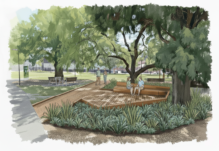
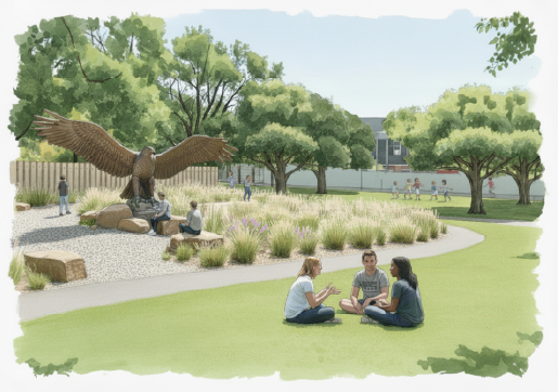
A peek into the future
Drag the slider to explore today’s view and tomorrow’s vision:
Reserve Rd
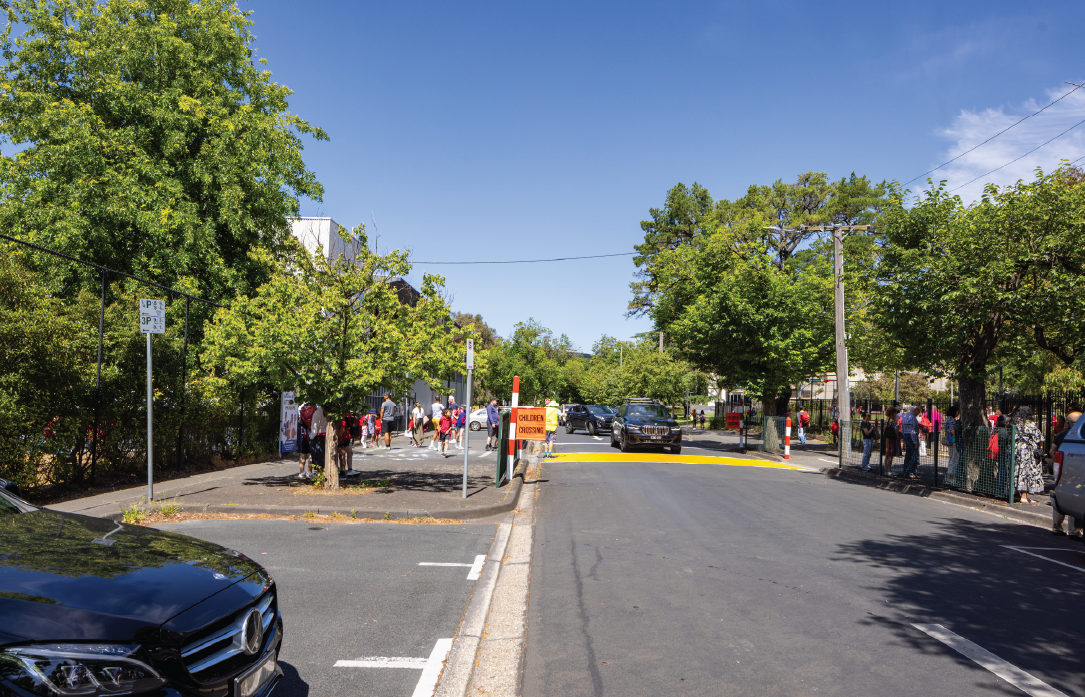
Reserve Road is located between Burke Road and Inglesby Road.
In December 2024, Council temporarily closed a section of Reserve Road due to safety concerns for children crossing to the two campuses of Camberwell Primary School. Find out more about the temporary closure.
After an 8-month trial and community feedback, Council decided to keep the road temporarily closed while the master plan for this area is being drafted. A report was presented to councillors at a public Council meeting held on Monday 8 September 2025 – read the report (PDF 2MB).
The draft master plan explores the option of permanently closing Reserve Road to create more open space. We want to hear what the community thinks about this idea.
Recommendations
Select the hotspots on the map to view the recommendations:
Hotspot colours in the above map align to each of the following focus areas:
![]() Liveability & public realm – elements to help you relax, play or enjoy the outdoors
Liveability & public realm – elements to help you relax, play or enjoy the outdoors![]() Identity & culture – celebrates the area’s unique character and history
Identity & culture – celebrates the area’s unique character and history![]() Connectivity – safer ways to get around by foot, bike or car
Connectivity – safer ways to get around by foot, bike or car![]() Environment – ways we can protect nature and create greener spaces
Environment – ways we can protect nature and create greener spaces
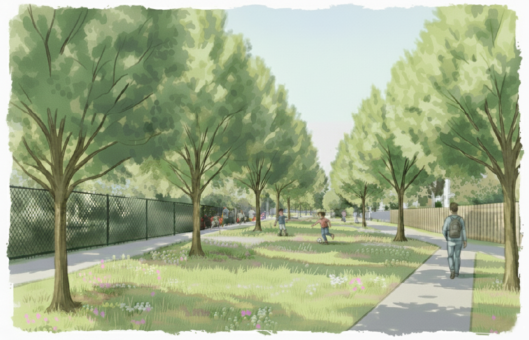
A peek into the future
Drag the slider to explore today’s view and tomorrow’s vision:
Boroondara Civic Precinct
The Boroondara Civic Precinct is in the centre of Camberwell Junction, located between Burke Road and Camberwell Road. It includes Camberwell Town Hall, the library and Council’s offices and customer service area. Together, these spaces attract around 268,000 visitors each year.
Recommendations
Select the hotspots on the map to view the recommendations:
Hotspot colours in the above map align to each of the following focus areas:
![]() Liveability & public realm – elements to help you relax, play or enjoy the outdoors
Liveability & public realm – elements to help you relax, play or enjoy the outdoors![]() Identity & culture – celebrates the area’s unique character and history
Identity & culture – celebrates the area’s unique character and history![]() Connectivity – safer ways to get around by foot, bike or car
Connectivity – safer ways to get around by foot, bike or car![]() Environment – ways we can protect nature and create greener spaces
Environment – ways we can protect nature and create greener spaces
A peek into the future
Drag the slider to explore today’s view and tomorrow’s vision (an artist’s impression showing what the small decks could look like for outdoor learning, events, and community gatherings):
Drag the slider to explore today’s view and tomorrow’s vision (an artist's impression showing what the Wurundjeri garden could look like):
Camberwell Rd & Burke Rd
We’re proposing streetscape upgrades and safer, more enjoyable walking routes along these busy commercial and transport corridors.
Recommendations
Select the hotspots on the map to view the recommendations:
Hotspot colours in the above map align to each of the following focus areas:
![]() Liveability & public realm – elements to help you relax, play or enjoy the outdoors
Liveability & public realm – elements to help you relax, play or enjoy the outdoors![]() Identity & culture – celebrates the area’s unique character and history
Identity & culture – celebrates the area’s unique character and history![]() Connectivity – safer ways to get around by foot, bike or car
Connectivity – safer ways to get around by foot, bike or car![]() Environment – ways we can protect nature and create greener spaces
Environment – ways we can protect nature and create greener spaces
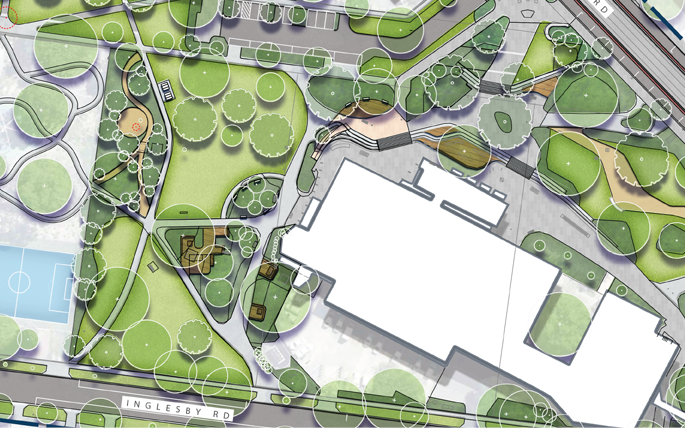
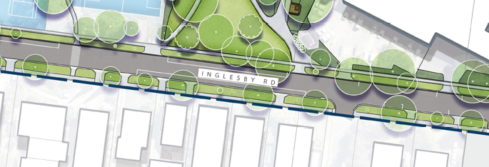
Inglesby Rd
We’re proposing minor streetscape improvements to maintain the local character of this residential street.
Recommendations
Select the hotspots on the map to view the recommendations:
Hotspot colours in the above map align to each of the following focus areas:
![]() Livability & public realm – elements to help you relax, play or enjoy the outdoors
Livability & public realm – elements to help you relax, play or enjoy the outdoors![]() Identity & culture – celebrates the area’s unique character and history
Identity & culture – celebrates the area’s unique character and history![]() Connectivity – safer ways to get around by foot, bike or car
Connectivity – safer ways to get around by foot, bike or car![]() Environment – ways we can protect nature and create greener spaces
Environment – ways we can protect nature and create greener spaces
Overarching plan
The overarching plan outlines the key recommendation that collectively form the Camberwell Civic Park.
Recommendations
- Keep the historic layout and character of the precinct while enhancing it with new landscaping and plantings.
- We’ll use Crime Prevention Through Environmental Design (CPTED) principles to guide our design. This means new facilities will be visible from surrounding areas, facing busy paths, and keeping the surroundings open with no hiding spots or obstructions.
- Preserve and celebrate the heritage and character of the area by protecting views to important buildings and landmarks, including the Basilica of Our Lady of Victories, the Uniting Church, Camberwell Primary School, St John’s Church, the Library, Town Hall and other nearby heritage buildings.
- Protect and celebrate the area’s heritage by updating the Statement of Significance, ensuring all important features and elements are recognised.
- Create a heritage walking tour with signs or markers to help visitors learn about and enjoy the area’s history.
- Work with Traditional Owners and Aboriginal and Torres Strait Islander communities in designing public spaces, so local histories and cultures are shared and celebrated.
- Review the existing trees in parks to see if any should be added to the Significant Tree Register.
- Use materials that are environmentally friendly and long-lasting, and recycle existing materials wherever possible.
- Consider possible future electric vehicle (EV) charging locations around Butler Street, Fairholm Grove or Inglesby Road car parks.
Consultation has closed
Survey
Drop-in sessions
Drop-in sessions
We held in-person sessions so you could chat with a Council officer about the draft plan:
- Saturday 18 October (12 pm midday to 1 pm)
- Wednesday 22 October (3 pm to 4 pm)
- Wednesday 5 November (5:30 pm to 6:30 pm)
- Saturday 15 November (12 pm midday to 1 pm)
Location
Camberwell Library
(in front of the library if not raining, or in the front entry lobby if raining)
340 Camberwell Road, Camberwell VIC 3124
Heritage walking tour
Join us for a free walking tour exploring the heritage landscapes of Camberwell Civic Park. Led by Dr Christina Dyson, a leading landscape heritage specialist from GML Heritage Consultancy, this tour offers a unique opportunity to learn more about the stories and cultural layers that shape our local environment.
The one-hour tour begins at the front of Camberwell Library, before making its way towards the Basilica of Our Lady of Victories. From there, we’ll move through the existing laneway to Lower Reserve, before returning to Camberwell Library. Along the way, Christina will share insights uncovered through the recent master planning work and encourage discussion about how we understand, value, and manage heritage in our community.
This is an engaging opportunity to experience Camberwell’s civic and cultural places in a new light, with expert interpretation and lively conversation.
When
Wednesday 29 October from 12 pm (midday) to 1 pm
Meeting point
Camberwell Library (at the front entrance) – 340 Camberwell Road, Camberwell VIC 3124


